Reblog> Author-Meets-More-or-Less-Friendlies: The Priority of Injustice at AAG 2018

The Priority of Injustice – Clive Barnett

Via Clive. This will be worth going to if you’re going to the AAG in 2018…

Author-Meets-More-or-Less-Friendlies: The Priority of Injustice at AAG 2018

I’m delighted to announce that the very wonderful Michael Samers has arranged an Author Meets Critics session on The Priority of Injustice, my new book (did I mention that?) at the annual meeting of the Association of American Geographers in New Orleans in April. It’s a great panel, with Joshua Barkan (U. of Georgia), Jennifer Fluri (U. of Colorado, Boulder), Leila Harris (UBC), and Kirsi Kallio (University of Tampere) all commenting on the book. The session is sponsored by AAG’s Political Geography Specialty Group and Ethics, Justice, and Human Rights Specialty Group. There’s a nice symmetry about the prospect of discussing the book in New Orleans – the last time the conference was there, in 2003, I presented a paper on theories of radical democracy that was my first post-Culture and Democracy effort at articulating the limits of broadly post-structuralist approaches to that topic, an effort that led eventually to the shape of The Priority of Injustice (yes, I’m a slow thinker).

Reblog> New paper: A smart place to work? Big data systems, labour, control, and modern retail stores

Gilbreth motion studies light painting

From the Programmable City team, looks interesting:

New paper: A smart place to work? Big data systems, labour, control, and modern retail stores

The modern retail store is a complex coded assemblage and data-intensive environment, its operations and management mediated by a number of interlinked big data systems. This paper draws on an ethnography of a superstore in Ireland to examine how these systems modulate the functioning of the store and working practices of employees. It was found that retail work involves a continual movement between a governance regime of control reliant on big data systems which seek to regulate and harnesses formal labour and automation into enterprise planning, and a disciplinary regime that deals with the symbolic, interactive labour that workers perform and acts as a reserve mode of governmentality if control fails. This continual movement is caused by new systems of control being open to vertical and horizontal fissures. While retail functions as a coded assemblage of control, systems are too brittle to sustain the code/space and governmentality desired.

Access the PDF here

Reblog > The Priority of Injustice

The Priority of Injustice – Clive Barnett

My colleague Prof. Clive Barnett’s excellent new book is out. He introduces it in a recent blogpost:

The Priority of Injustice

So, finally, the book that I have been writing, on and off, for the last four years, The Priority of Injustice, has been published – or at least, it’s real, since the formal publication date is next month (so I reserve the right to blog further about it as and when). It arrived earlier this week – a rather hectic week, which has oddly meant I have been too busy to experience the strange sense of anti-climax that often accompanies the arrival of the finished form of something that you have been making for so long.

This is, in one sense, my Exeter book – the first thing I did in my very first week here, four years ago, was write the proposal and send it off to prospective publishers, It’s also, though, my Swindon book, a book which attempts to articulate an approach to theorising in an ordinary spirit which has been published just a few weeks after moving away from that very ordinary town where I have lived while writing it.

It’s a beautiful object, with a great cover image, by Helen Burgess (I bought one of her pictures once, in one of those open-house art trail events that you get in places like Bishopston in Bristol, so that’s why I knew of her work; it turns out she is part of a geography-friendly network of artists). And I am honoured and humbled to have the book published in University Georgia Press’s very excellent Geographies of Justice and Social Transformation series.

I’m now faced with the challenge of promoting the book. I’m quite fond of the Coetzee-esque principle that books should have to make their own way in the world without the help of the author; on the other hand, I have some sense of responsibility towards the argument made in the book, a responsibility to help project it into the world. I’ve already realised that it’s not the sort of book that lends itself to an easy press release – ‘THEORY COULD BE THEORISED DIFFERENTLY’, SAYS THEORY-BOY doesn’t really work as a headline, does it?.

Read the full blogpost.

Gender, Place & Culture annual award for new & emerging scholars

People in a large conference hall

This is a good initiative from Gender, Place & Culture and I am sure it will help those awarded. I hope we can all encourage eligible candidates to apply!

Annual Award for New and Emerging Scholars

Application closing date: 26 January 2018

The editorial team of Gender, Place and Culture is pleased to announce an annual award valued at a maximum of US$1,500 for new and emerging scholars. The award is targeted at emerging researchers in feminist geographies who are trying to establish research careers and create research momentum. The purpose is to support the research programme of promising feminist geographers and to give an impetus to their careers. The applicant should be involved in independent research and not be merely part of a larger group’s research project. Priority for this award will be given to current graduate students or faculty members within three years of receiving their PhD who are situated in partially or poorly funded positions, who work in departments where little or no money is available for conference participation and who have no recourse to grants from funding agencies such as the Economic and Social Research Council in the UK and the National Science Foundation in the USA or equivalent (if you currently hold one of these grants or have just completed one you will not be considered eligible for this award).

This award is intended to be used for attendance at an international conference of your choice, at which you will present a paper on a topic relating to feminist geography. The successful applicant is expected to use the award within one year of its receipt.

Applicants are asked to submit the following:

  • an abstract of the conference paper (250-300 words) and conference information including, if possible, confirmation of acceptance of your paper;
  • an academic CV;
  • a paragraph outlining how your research contributes to feminist geography;
  • a proposed budget (for accommodation, travel, conference fees, per diem, etc.);
  • and a cover letter including your contact details (mailing address, email, and telephone number).

Please send your applications to the Managing Editor, Pamela Moss, by 26 January 2018. A decision on the award will be made within 4 to 6 weeks of this deadline. Within one month of attending the conference the successful applicant is expected to submit receipts as well as a one page report.

Idle digital signage

When you forget some essentials in your supermarket delivery and find yourself in the 24-hour supermarket at 10 o-clock at night you can see some vaguely (or not) interesting things… Here’s some “digital signage” (look, it says so – see?) that seems to have nothing to signify but it tells you some stuff… it doesn’t seem to be ‘online’, it has a measly 5Gb of storage and it has a hardware ID. I sort of think it’s quite nice to see the crap-ness of things like this when we get buffeted with promises/warnings of digital signage that profiles us, our cars and so on…

Teaching digital geographies – a call

An email was circulated earlier today on behalf of the Digital Geographies Working Group of the RGS-IBG asking the following:

The Digital Geographies Working Group of the RGS/IBG is hoping to develop a resource for those of us interested in teaching ‘digital geographies’.

If you teach a module to undergraduate or postgraduate students that’s about digital geographies, however defined, and have a course handbook or syllabus or website that you’re willing to share by having it posted on the DGWG website, please send a copy to Gillian Rose copying in Jeremy Crampton.

We’ll gather them together and let you know when they’re all available on our website, http://www.digitalrgs.org.

Just thought it may be worth sharing as some people may find this of interest…

Roadside billboards display targeted ads in Russia

racist facial recognition

From the MIT Tech Review:

Moscow Billboard Targets Ads Based on the Car You’re Driving

Targeted advertising is familiar to anyone browsing the Internet. A startup called Synaps Labs has brought it to the physical world by combining high-speed cameras set up a distance ahead of the billboard (about 180 meters) to capture images of cars. Its machine-learning system can recognize in those images the make and model of the cars an advertiser wants to target. A bidding system then selects the appropriate advertising to put on the billboard as that car passes.

Marketing a car on a roadside billboard might seem a logical fit. But how broad could this kind of advertising be? There is a lot an advertiser can tell about you from the car you drive, says Synaps. Indeed, recent research from a group of university researchers and led by Stanford found that—using machine vision and deep learning—analyzing the make, model, and year of vehicles visible in Google Street View could accurately estimate income, race, and education level of a neighborhood’s residents, and even whether a city is likely to vote Democrat or Republican.

As the camera spots a BMW X5 in the third lane, and later a BMW X6 and a Volvo XC60 in the far left lane, the billboard changes to show Jaguar’s new SUV, an ad that’s targeted to those drivers.

Synaps’s business model is to sell its services to the owners of digital billboards. Digital billboard advertising rotates, and more targeted advertising can rotate more often, allowing operators to sell more ads. According to Synaps, a targeted ad shown 8,500 times in one month will reach the same number of targeted drivers (approximately 22,000) as a typical ad shown 55,000 times. The Jaguar campaign paid the billboard operator based on the number of impressions, as Web advertisers do. The traditional billboard-advertising model is priced instead on airtime, similar to TV ads.

In Russia, Synaps expects to be operating on 20 to 50 billboards this year. The company is also planning a test in the U.S. this summer, where there are roughly 7,000 digital billboards, a number growing at 15 percent a year, according to the company. (By contrast, there are 370,000 conventional billboards.) With a row of digital billboards along a road, they could roll the ads as the cars move along, making billboard advertising more like the storytelling style of television and the Internet, says Synaps’s cofounder Alex Pustov.

There are limits to what the company will use its cameras for. Synaps won’t sell data on individual drivers, though the company is interested in possibly using aggregate traffic patterns for services like predictive traffic analysis and the sociodemographic analysis of commuters versus residents in an area, traffic emissions tracking, or other uses.

Out of safety concerns, license plate data is encrypted, and the company says it will comply with local regulations limiting the time this kind of data can be stored, as well.

Well that’s alright then! 😉

Getting in ‘the zone’: Luxury & Paranoia, Access & Exclusion – Capital and Public Space

Uber surge pricing in LA

Another interesting ‘long form’ essay on the Institute of Network Cultures site. This piece by Anastasia Kubrak and Sander Manse directly addresses some contemporary themes in geographyland – access, ‘digital’-ness, exclusion, ‘rights to the city’, technology & urbanism and ‘verticality’. The piece turns around an exploration of the idea of a ‘zone’ – ‘urban zoning’, ‘special economic zones’, ‘export processing zones’, ‘free economic/enterprise zones’, ‘no-go zones’. Some of this, of course, covers familiar ground for geographers but its interesting to see the argument play out. It seems to resonate, for example, with Matt Wilson’s book New Lines…

Here’s some blockquoted bits (all links are in the original).

Luxury & Paranoia, Access & Exclusion On Capital and Public Space

We get into an Uber car, and the driver passes by the Kremlin walls, guided by GPS. At the end of the ride, the bill turns out to be three times as expensive than usual. What is the matter? We check the route, and the screen shows that we travelled to an airport outside of Moscow. Impossible. We look again: the moment we approached the Kremlin, our location automatically jumped to Vnukovo. As we learned later, this was caused by a GPS fence set up to confuse and disorient aerial sensors, preventing unwanted drone flyovers.

…

How can we benefit as citizens from the increase in sensing technologies, remote data-crunching algorithms, leaching geolocation trackers and parasite mapping interfaces? Can the imposed verticality of platform capitalism by some means enrich the surface of the city, and not just exploit it? Maybe our cities deserve a truly augmented reality – reality in which value generated within urban space actually benefits its inhabitants, and is therefore ‘augmented’ in the sense of increased or made greater. Is it possible to consider the extension of zoning not only as an issue, but also as a solution, a way to create room for fairer, more social alternatives? Can we imagine the sprawling of augmented zones today, still of accidental nature, being utilized or artificially designed for purposes other than serving capital?

…

Gated urban enclaves also proliferate within our ‘normal’ cities, perforating through the existing social fabric. Privatization of urban landscape affects our spatial rights, such as simply the right of passage: luxury stores and guarded residential areas already deny access to the poor and marginalized. But how do these acts of exclusion happen in cities dominated by the logic of platform capitalism? What happens when more tools become available to scan, analyze and reject citizens on the basis of their citizenship or credit score? Accurate user profiles come in handy when security is automated in urban space: surveillance induced by smart technologies, from electronic checkpoints to geofencing, can amplify more exclusion.

This tendency becomes clearly visible with Facebook being able to allow for indirect urban discrimination through targeted advertising. This is triggered by Facebook’s ability to exclude entire social groups from seeing certain ads based on their user profile, so that upscale housing-related ads might be hidden from them, making it harder for them to leave poorer neighborhoods. Meanwhile Uber is charging customers based on the prediction of their wealth, varying prices for rides between richer and poorer areas. This speculation on value enabled by the aggregation of massive amounts of data crystallizes new forms of information inequality in which platforms observe users through a one-way mirror.

…

If platform economies take the city as a hostage, governmental bodies of the city can seek how to counter privatization on material grounds. The notorious Kremlin’s GPS spoofing fence sends false coordinates to any navigational app within the city center, thereby also disrupting the operation of Uber and Google Maps. Such gaps on the map, blank spaces are usually precoded in spatial software by platforms, and can expel certain technologies from a geographical site, leaving no room for negotiation. Following the example of Free Economic Zones, democratic bodies could gain control over the city again by artificially constructing such spaces of exception. Imagine rigorous cases of hard-line zoning such as geofenced Uber-free Zones, concealed neighborhoods on Airbnb, areas secured from data-mining or user-profile-extraction.

…

Vertical zoning can alter the very way in which capital manifests itself. The‘Bristol pound’ is an example of city-scale local currency, created specifically to keep added value in circulation within one city. It is accepted by an impressive number of local businesses and for paying monthly wages and taxes. Though the Bristol Pound still circulates in paper, today we can witness a global sprawl of blockchain based community currencies, landing within big cities or even limited to neighborhoods. Remarkably, Colu Local Digital Wallet can be used in Liverpool, the East London area, Tel Aviv and Haifa – areas with a booming tech landscape or strong sense of community.

Reblog> Book: New Lines

Via Matt Wilson.

Book: New Lines

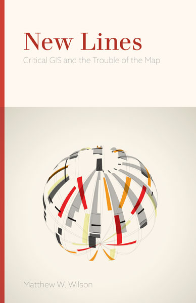
I am beyond thrilled to learn that New Lines: Critical GIS and the Trouble of the Map is now in print. This book is my attempt to re-examine the practice of mapmaking, amidst the troubles that the map presents. The abstract and endorsements of the text, now available from University of Minnesota Press, follows. You can also receive 30% off when you order at www.upress.umn.edu, using discount code MN81730. Offer expires Jan. 1, 2018.

“With rapidly shifting digital technologies, geo-surveillance, everyday cartography, privatized georeferenced data, and neoliberalization, New Lines offers a reflexive reassessment of the scholarly praxis of critical GIS, an increasingly anachronistic term. Attentive also to contemporary philosophical debates, Matthew W. Wilson’s lively and ambitious manifesto pushes the reader to re-examine everything they thought they knew about the topic.”
Eric Sheppard, UCLA


“This elegantly argued book offers a brilliantly original perspective on the many ‘troubles’—technical, epistemological, cultural, and political—associated with the contemporary proliferation of digital mapping systems. For anyone interested in understanding the rapidly changing sociohistorical, technological and institutional contexts in which cartographic practice occurs, Matthew W. Wilson’s New Lines will provide a foundational source of insight, wisdom, inspiration, and provocation.”

Neil Brenner, Harvard University

Reblog> Martin Dodge and Rob Kitchin, Mapping Cyberspace (free book download)

Via Stuart Elden.

Mapping Cyberspace was a formative introduction to ‘geography’ for me as an undergraduate digital arts student. It certainly influenced my (all-too-naive) BSc dissertation ideas… It’s great this is available, it documents so many things that seemed so vital at the time and that now appear almost like peculiar mirages.

Martin Dodge and Rob Kitchin, Mapping Cyberspace (free book download)

Mapping Cyberspace – Martin Dodge & Rob KitchinMartin Dodge and Rob Kitchin’s 2001 book Mapping Cyberspace is now available as a free download. There is also a website about the book here.

Mapping Cyberspace is a ground-breaking geographic exploration and critical reading of cyberspace, and information and communication technologies. The book:

  • * provides an understanding of what cyberspace looks like and the social interactions that occur there
  • * explores the impacts of cyberspace, and information and communication technologies, on cultural, political and economic relations
  • * charts the spatial forms of virtual spaces
  • * details empirical research and examines a wide variety of maps and spatialisations of cyberspace and the information society

has a related website at http://www.MappingCyberspace.com.

This book will be a valuable addition to the growing body of literature on cyberspace and what it means for the future.